River & Desert

River & Desert
River & Desert
An orphan's Atlantic crossing, a wagon trail into the desert, and the water that made towns possible.
I
n the fall of 1882, a man with failing lungs loaded his wife and children into a wagon and pointed south toward Arizona. William Nicholas Goodman was forty years old, an English carpenter who had crossed the Atlantic two decades earlier with nothing but his younger brother and a convert's faith. He had built homes in Utah. Now Utah's cold was killing him. [S7]S7 — Archived WebsiteKindredPast: The Goodman Family of St. David, Arizona (Archived)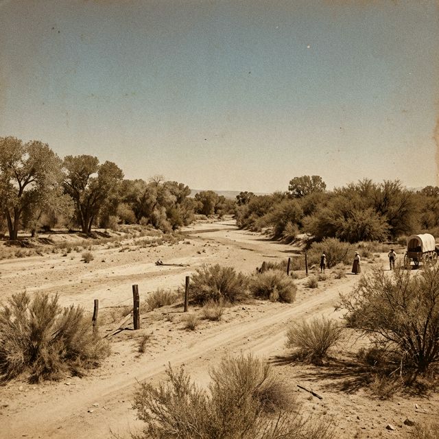
They stopped first in Mesa, then pressed on to St. David, a tight-knit farming settlement in the San Pedro River Valley, named for the Mormon leader David P. Kimball. Margarett's sister Maria had already settled there with her husband Joseph McRae. Near the cemetery, William and his sons molded adobe bricks by hand, cut mesquite, and dug irrigation ditches. They planted wheat and barley in desert soil.
[S27]S27 — UnknownSource: S27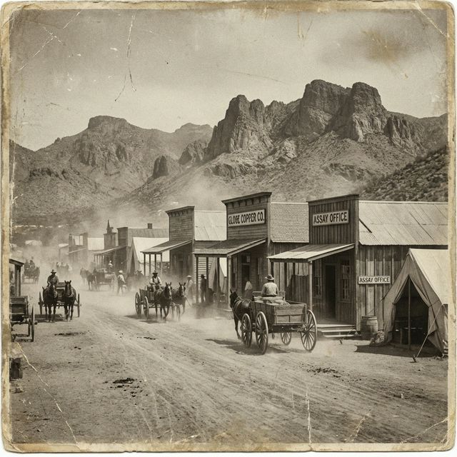
Profile: William Nicholas Goodman

William died on March 8, 1885, three years after arriving, at age forty-three. His death could have ended the Goodman story in Arizona. Instead, his widow Margaret Ann stayed. She sold the family's only cow, bought some bars of soap, and built a store from her front room. Her eldest son George Edward took up the freight whip at fourteen, driving teams across southern Arizona for the next twenty years.
[S7]S7 — Archived WebsiteKindredPast: The Goodman Family of St. David, Arizona (Archived)The desert transformed
The land around Mesa and Chandler was naturally hostile to farming. What made it possible was water, specifically the Salt River and the network of irrigation canals that turned desert hardpan into agricultural gold. The Tempe Canal was one documented piece of that network, a vital artery in the system that let families like the Goodmans and Ellsworths put down roots.
[S15]S15 — UnknownSource: S15

Chandler's gamble
In 1891, a veterinarian named Dr. A.J. Chandler bought eighty acres south of Mesa and taught himself irrigation engineering. By 1900, he had assembled an 18,000-acre ranch, though not without controversy. Chandler exploited the Desert Land Act of 1877, recruiting employees and associates to file land claims in their own names through an "Improvement Company." Each participant received forty acres free; in exchange, Chandler's company took mortgages on the remaining six hundred, mortgages designed to default. Historians have called this "land fraud," noting that claimants perjured themselves by denying any outside financial interest.
[S13]S13 — UnknownSource: S13 [S26]S26 — UnknownSource: S26
When the Salt River Project charter capped each landowner at 160 irrigated acres, Chandler pivoted. He brought planners and architects to lay out a townsite and market farm lots to the public.
[S13]S13 — UnknownSource: S13By mid-May 1912, excursion trains brought hundreds of buyers to Chandler's townsite office. The day's sales topped $50,000. The "town" consisted of a few wooden shacks, a dining hall, and a small grocery, just enough to mark a beginning.
[S13]S13 — UnknownSource: S13Chandler's plan centered on a landscaped park bisected by a canal, with a promised Hotel San Marcos and deed restrictions requiring landowners to build within a year. It was an orderly, ambitious blueprint for a desert town that bet everything on growth.
[S13]S13 — UnknownSource: S13
